GeoGuessr country clues
Read country clues with worked photo examples: plate colours, speed units, web domains, driving direction and common Japan–Taiwan or Britain–Ireland mix-ups.

Use a sequence, not a magic clue
Good country guesses combine evidence. First identify a broad region, then compare the details that distinguish plausible countries. This guide focuses on visible signs and infrastructure rather than memorising camera-car details. It follows the first-round routine, with more attention to what each clue can actually establish.
A useful habit is to name both your leading country and an alternative. Ask what you would need to see to separate them. That question gives your next pan or movement a purpose.
Writing systems and place names
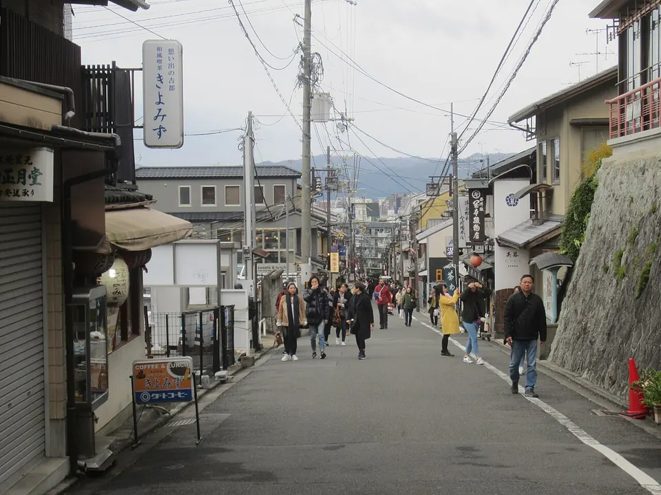
Japanese kana can help distinguish Japanese text from a sign that contains only shared Chinese characters. Hangul is a strong lead towards Korea. Cyrillic narrows the possibilities, but it does not automatically mean Russia: several countries use it. Latin lettering is shared across a very large part of the world.
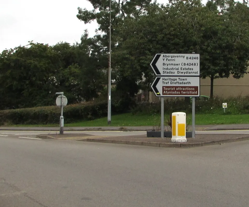
A place name, national web domain or road destination can add specificity. Cross-check it against other signs. A business can advertise a foreign place or use a foreign language. A bilingual sign can reveal more than either language alone, especially when both names refer to the same destination.

Driving direction and road markings
Use actual moving traffic, lane arrows and junction layouts to infer the driving side. A parked car is weak evidence. Left-side driving leaves several possible countries, including Japan, the United Kingdom, Australia and South Africa; it does not finish the guess.
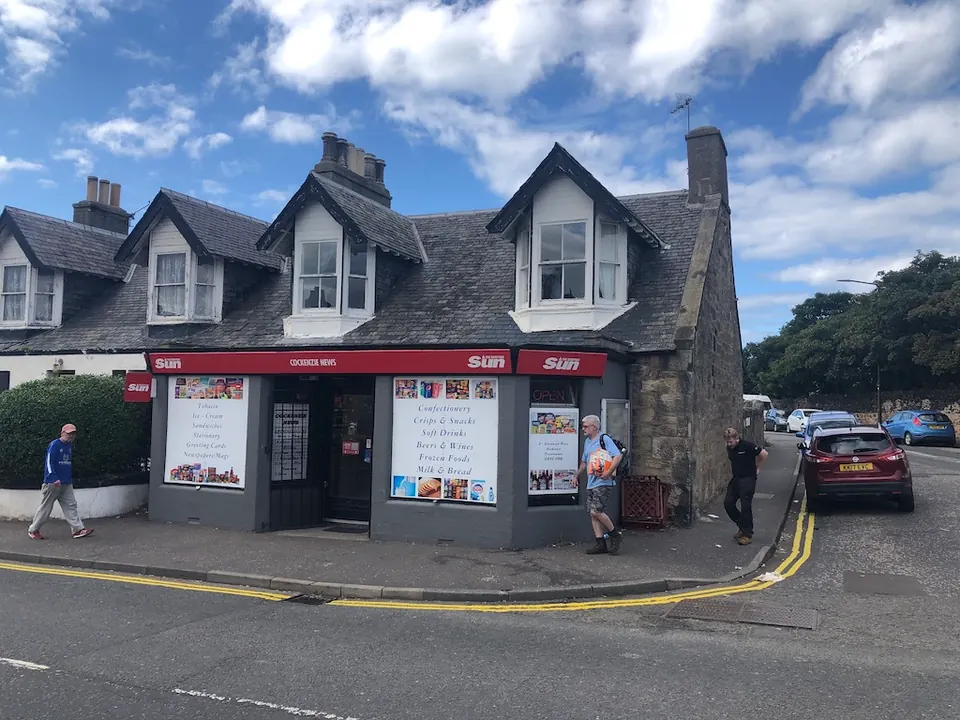
Road markings are context clues. Ask whether the yellow line separates traffic or marks the edge of a road. In Britain, double yellow lines along a kerb concern parking restrictions; they are not evidence that you are looking at an American road centreline. Compare the line’s function before comparing its colour.

Common mix-ups to practise
| Candidates | Useful next evidence | Why the first clue is insufficient |
|---|---|---|
| Japan and Taiwan | Kana, repeated local place names, moving traffic | Shared Chinese characters appear in both |
| United Kingdom and Ireland | Road destinations, route systems, repeated language patterns | Both drive on the left and have many green landscapes |
| Australia and South Africa | Place names, route signs, multiple landscape and infrastructure details | Left-side traffic and dry scenery fit both |
| Countries using Cyrillic | Distinctive letters, town names, national domains | The alphabet family alone is not a country identifier |
These are prompts for investigation, not a checklist that guarantees an answer. Border areas, imported vehicles, tourist signs and unusual coverage can all produce exceptions.
Use landscape as a cross-check
Vegetation, terrain and climate can support or challenge a hypothesis. They are less reliable as a lone identifier. A green hillside occurs in many climates; a dry road does not imply one continent. Compare several features over the visible route instead of making a decision from one tree.
Street-view coverage changes, and a map’s location pool is not a neutral sample of the world. Learn coverage alongside your clues, using current provider information rather than an old list of countries that supposedly never appear.
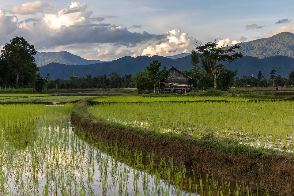

Plate colours: compare the front and rear
The UK’s published number-plate rules specify black characters on white at the front and yellow at the rear. When several ordinary cars show that pattern, it is more useful than remembering only “yellow plate”. First work out which end of the car you are seeing.
Treat a single vehicle cautiously: it may be visiting, the image may blur the colour, or you may not be looking at a typical passenger car. Plate colour supports a country hypothesis; it does not justify reading an unreadable registration number or declaring an exact town.
Speed units help separate Britain and Ireland
The UK publishes road speed limits in miles per hour, while the Republic of Ireland’s driving guidance specifies kilometres per hour for limits and modern road signs. Read a visible unit or the wider road-sign system rather than treating a bare “50” as sufficient evidence.
This distinction is between jurisdictions, not between islands: Northern Ireland is part of the UK. “Green landscape plus left-side driving” is not enough to decide between Britain, Northern Ireland and the Republic of Ireland. Combine units with destinations, route identifiers and other independent details.
Three web suffixes worth recognising
| Visible suffix | Registry association | How to use it |
|---|---|---|
| .jp | Japan | Compare with Japanese writing and road evidence |
| .tw | Taiwan | Compare with local place names and actual traffic |
| .uk | United Kingdom | Compare with the road-sign and vehicle pattern |
These associations are listed by IANA for .jp, .tw and .uk. Read the end of the domain, not a substring in an advertisement. A business can advertise a website from another country, so a suffix is a clue about the site, not a geolocation certificate for the camera.
Make the Japan–Taiwan comparison concrete
Japan’s national tourism organisation confirms left-side driving; the Plonk It Taiwan guide identifies right-side driving in Taiwan. With that pair of candidates, actual traffic direction can therefore separate them more effectively than the presence of shared Chinese characters alone.
Combine it with the writing: clearly visible kana supports Japan, while Chinese characters alone leave more possibilities open. Recheck several moving vehicles or a junction before deciding; a parked vehicle or a one-way street can give the wrong impression. This comparison applies to those candidates, not to every place in East Asia.
Work through the cover photograph
The linked source places the bilingual-sign photograph in Blaenavon, Wales. The visible sign gives Abergavenny / Y Fenni and road number B4246. A useful reading order is: copy the destination pair, note the route number, then compare how the junction and arrow directions fit a map. You now have testable evidence beyond “this feels British”.
The photograph’s published location is known to us, but that does not make this a blind guessing success. Use it as a study example: identify which clues you could have used without the caption, and which details only became available from the source. Then practise the same distinction on a new round.
Practise one distinction at a time
After a wrong guess, compare the actual country with your chosen country. Identify one observable distinction to look for next time. Save a short note in your own words rather than copying an entire country guide. Once basic country recognition becomes comfortable, move to region guessing within one country.
Try a few rounds on GeoGuesser, then revisit the table with your own examples. For a different type of map practice, Farflung practice edition asks you to combine written clues. It trains clue comparison, while street-view play remains the way to practise visual country recognition.
Test your observation
A road sign uses the Latin alphabet. Can you identify the country from that alone?
No. Many countries share the same alphabet. Look for a second independent clue, such as a place name, road sign, or driving side.
Frequently asked questions
Can the sun always tell me which hemisphere I’m in?
No. Sun direction depends on latitude, season and time of day. Use it cautiously and combine it with independent evidence.
Do yellow road lines always mean the Americas?
No. Yellow lines serve different purposes in different countries. Check their position and function, then compare other clues.
Does a country-code web domain prove the camera location?
No. It identifies the website’s country-code association. A business can advertise a foreign website, so combine it with local signs and road evidence.